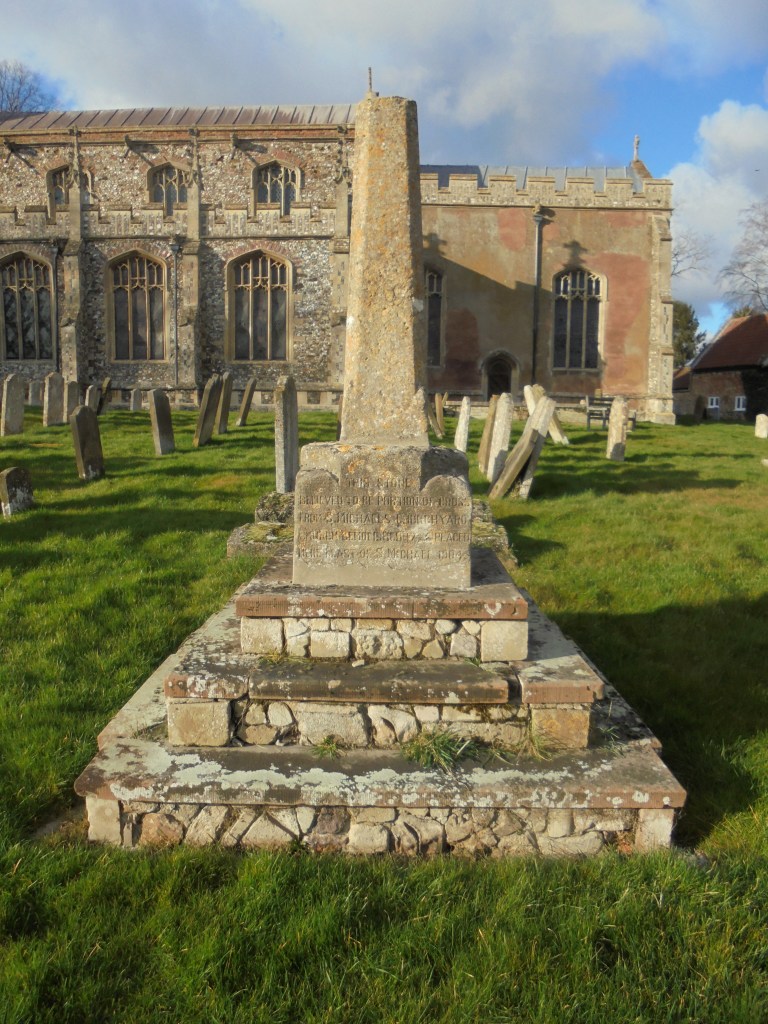
Many villages in the county once possessed a cross situated on a public highway that would act as a focal point in what would often be an extended area where a market could be held. The churchyard of St Martin’s Church retains a fragment of a medieval cross that originates from an uncertain date. The base of the fragment reads:
THIS STONE
BELIEVED TO BE PORTION OF CROSS
FROM St MICHAEL’S CHURCHYARD
CHURCH DEMOLISHED 1745 PLACED
HERE EAST OF St MICHAEL’S 1904
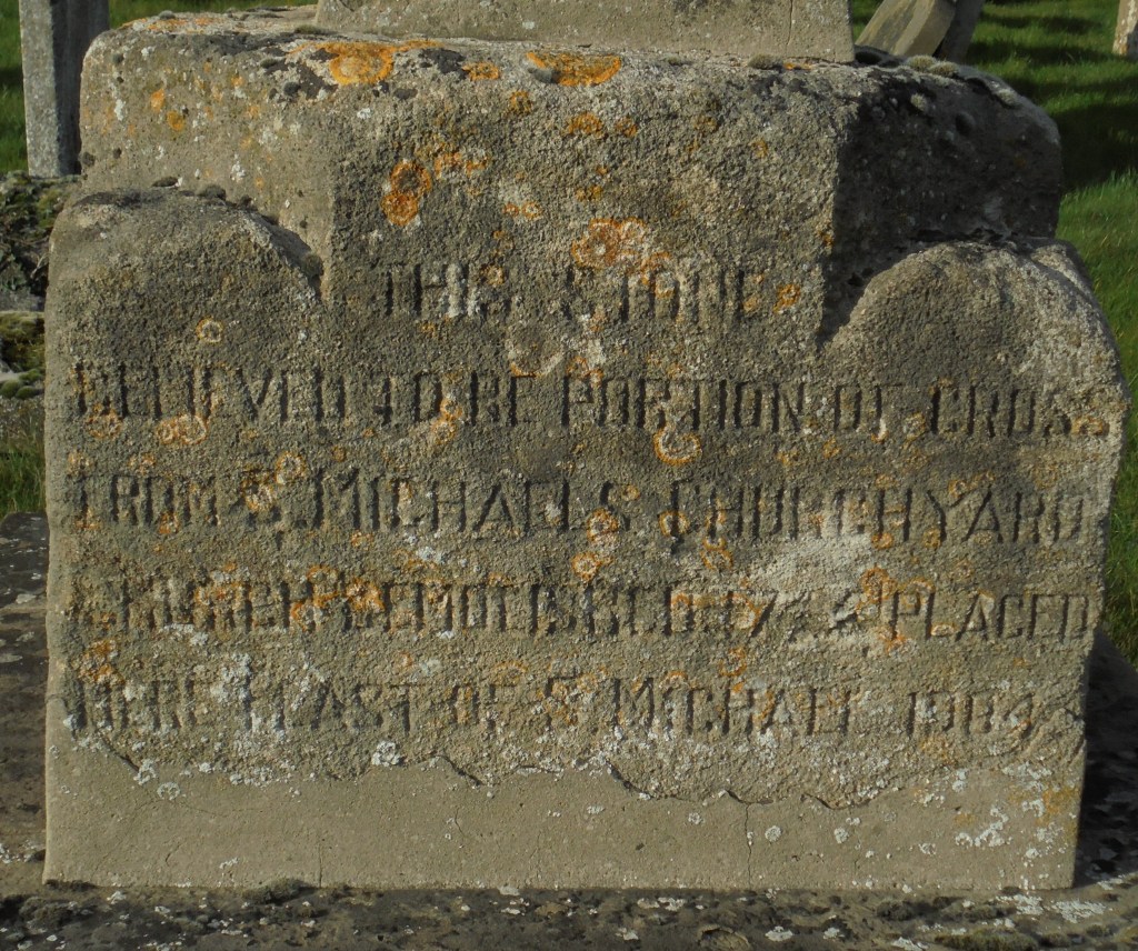
The weathered inscription may however reveal only part of the stone’s history. It is believed that this cross may have originally been positioned at the Downham Road / Lynn Road junction to the west of the village at a time when this was a much more open space that incorporated a large pond. If indeed this was the case, then at some point the cross was moved to St Michael’s churchyard. In 1745 the new rector William Harvey was responsible for the demolition of St Michael’s church and It was William Blyth who wrote in his diary in December 1866:
Erected last Friday (21st), in the Rectory garden, the base of the old village cross, which stood near Talbot’s manor house, where the road branches off for Lynn. It is a very hansom stone 2ft 2inches square below, and 2ft 2inches high, the upper part being octagonal from a circular pillar at the junction.
The cross base was placed in the rectory garden as a support for a rain gauge or sun dial, but it does not seem to have rested there long. It was moved again in March 1875 to a new position 460m due south into a meadow belonging to the rectory. Quite why the cross was placed in this isolated position remains open to question. The cross was not located on a public thoroughfare of any sort but on church owned land remote from the village and adjacent to a pond known in the village as “the Pinnacle Pit”. Was the “pinnacle” considered merely an architectural feature that would act as a picturesque focal point visible only from the upper floor of the rectory, or does its position bear some deeper significance? It is possible that the stone was used as a Glebe Marker to denote the limit of the extent of land held by the church in the village. In the nearby village of Beachamwell their old stone cross was put to precisely this use. In 1904 the cross was moved to its current location whilst the later pedestal that remained at the field site was finally demolished in 1978.
